Not far from BCE’s digs,,, Thats a little island he is on in that bay, and it looks like its part of some park system, but far enough off shore to keep from running afoul of riff-raff. Last time I was in Tampa there were a few thugs runnin’ around, and I don’t believe the situation has improved over the last near twenty years. Big Country can likely expand on that, mehbie,,,,
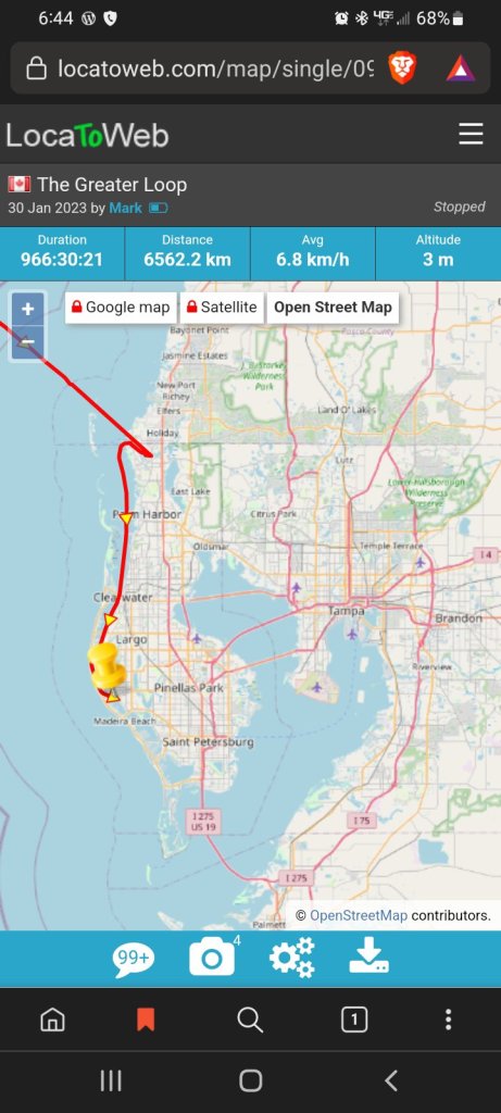
here’s the link if you wanna follow along, message him with cheers as he paddles or whatever. messages are only delivered while the trace is active, so he isn’t likely to respond back, but seeing how many do message him, he has lots of fans. (myself included,,,) but the trace is REAL TIME so long as his phone is on. The current track shows a straight line from off-shore to inland, so I would imagine his phone was off for a spell before he kicked off this morning.

Good to see he’s OK. Hopefully, he got a bit of rest. I’m about ~45 miles inland from him, for better or worse.
LikeLike
if there is a cross water way there, thats where he will be crossing to the Atlantic side. His tentative map shows a cross over not going around the keys or the Glades.
LikeLike
I’m sure he’ll be using the Okeechobee waterway. Been that route many times myself. Goes from Ft. Myers up the Callusahatchee river , over to St. Lucy. The lake can be extremely volatile when fronts come through. If he takes the southern rim route , he only will have about a five mile run of big water to cross.
LikeLiked by 1 person
I believe that is his plan. It matches what his tentative scrawled maps showed. He may have one or two small open water crossings to get to Ft Meyer, but after what he experianced off Nova Scotia, he should be fine. The oly issue with dynamic water on inland lakes is unpredictability. It doesnt take much to get the water to stand up
LikeLike
Especially when it is all very shallow. Lots of small islands where he’s at right now (though) also lots of development).
Once he gets to Venice , there is a lot more protected waters
LikeLike